
Professional Land Surveying Services in Malaysia
Reliable Surveying Solutions for Land, Property & Development Projects
Your Trusted Partner in Land Surveying & Geospatial Solutions
At Jurukur Murni, we understand the importance of accurate surveying data and proper documentation in every land and development project.
We provide a comprehensive range of land surveying services, combining technical expertise, modern surveying technology, and an understanding of Malaysian land administration requirements.
Whether you are planning a property development, managing land title matters, or undertaking an infrastructure project, we aim to deliver reliable surveying solutions that support informed decisions and efficient project execution.
Our Main Services
Explore our professional surveying services, designed to meet the technical and regulatory requirements of landowners, developers, consultants, and construction professionals.
Strata Title Survey
Professional surveying and technical support for SiFUS, CPSP, and Strata Title applications, from initial submission through to the issuance of strata titles.
Title Survey
Professional title surveying services and compliant survey documentation to support land subdivision, partition, amalgamation, and individual title applications.
(GIS) Services
Geospatial mapping and land data integration solutions that support development planning, spatial analysis, and effective land information management.
Hydrographic Survey Services
Hydrographic surveying solutions for water depth measurement, river mapping, and waterfront development projects, providing essential data for marine and water-based planning.
Land & Housing Development Services
Surveying and technical support for land and housing development projects, helping developers and project stakeholders manage survey-related requirements throughout the development process.
Engineering, Topographical & Aerial Surveys
Ground-based and aerial surveying solutions for construction setting out, terrain mapping, and infrastructure planning.
How Our Surveying Process Works
From initial consultation to survey execution and final documentation, we follow a structured approach to deliver accurate surveying data and reliable technical support for your project.
LAND & PROPERTY OWNERSHIP
Supporting Land Titles & Strata Ownership with Confidence
Land ownership and strata title matters involve important surveying requirements, technical documentation, and application procedures.
Jurukur Murni provides professional surveying support for land title matters, including subdivision, partition, amalgamation, SiFUS, CPSP, and Strata Title applications.
Our team helps property owners and developers navigate survey-related requirements with greater clarity throughout the process.


LAND DEVELOPMENT & INFRASTRUCTURE
Building a Strong Foundation for Every Development
Successful developments begin with accurate land information and proper surveying preparation.
From topographical surveys and construction setting out to engineering measurements, Jurukur Murni provides essential survey data to support project planning and construction activities.
We work with developers, engineers, and project consultants to support informed decisions throughout the development process.
About us
ADVANCED SURVEYING TECHNOLOGY
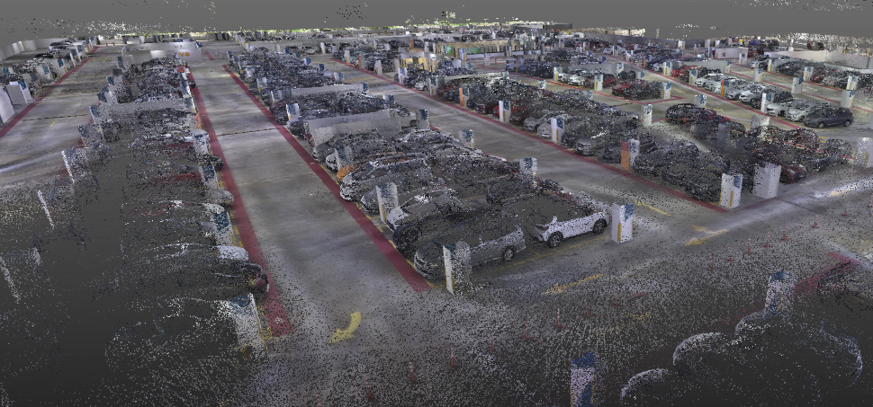
Modern surveying goes beyond traditional land measurements. Advanced geospatial technologies provide valuable information for planning, analysis, and project management.
Through GIS, aerial mapping, and digital surveying solutions, Jurukur Murni helps clients collect, visualise, and interpret spatial information for a wide range of development applications.

HAVE A PROJECT IN MIND?
LET'S DISCUSS YOUR SURVEYING NEEDS
From land title matters to property development and engineering surveys, Jurukur Murni is ready to provide professional surveying solutions tailored to your project requirements.